History & story.
Son Tra Peninsula juts into the East Sea like a natural breakwater sheltering Da Nang Bay, spanning over 4,400 hectares of pristine tropical rainforest just a few kilometres from the city. It is one of the last remaining intact lowland rainforests in Central Vietnam, supporting 287 bird species, 106 reptile species, and most famously a population of red-shanked douc langurs — described by scientists as 'the world's most colourful primate' for their spectacular five-colour coat. From the 19th century Son Tra served as a French military outpost; during the Vietnam War US forces positioned the STRATCOM radar and communications facility atop 696-metre Bàn Cờ Peak, calling the mountain 'Monkey Mountain' for its abundant langur population. Today the peninsula is protected as a nature reserve and is a favourite hiking, camping, and douc-spotting destination for Da Nang's younger generation.
The red-shanked douc langur (Pygathrix nemaeus) is IUCN-listed as Endangered, and Son Tra contains 50–60% of the world's entire remaining population. Their five-colour coat — flame-orange face, white neck, grey torso, vivid red thighs, and black limbs — makes them among the most beautiful creatures in Vietnam. In the early morning from 6–8 am, troops of 10–20 individuals descend close to trails and forest-edge roads to forage on young leaves and fruit — this is the optimal viewing window. Unlike beach destinations, Son Tra has no opening hours: nature lovers can visit any time, but arriving before dawn delivers a wholly different experience — mist still hanging in the forest canopy, morning birdsong, and langur silhouettes moving through the dappled dark.
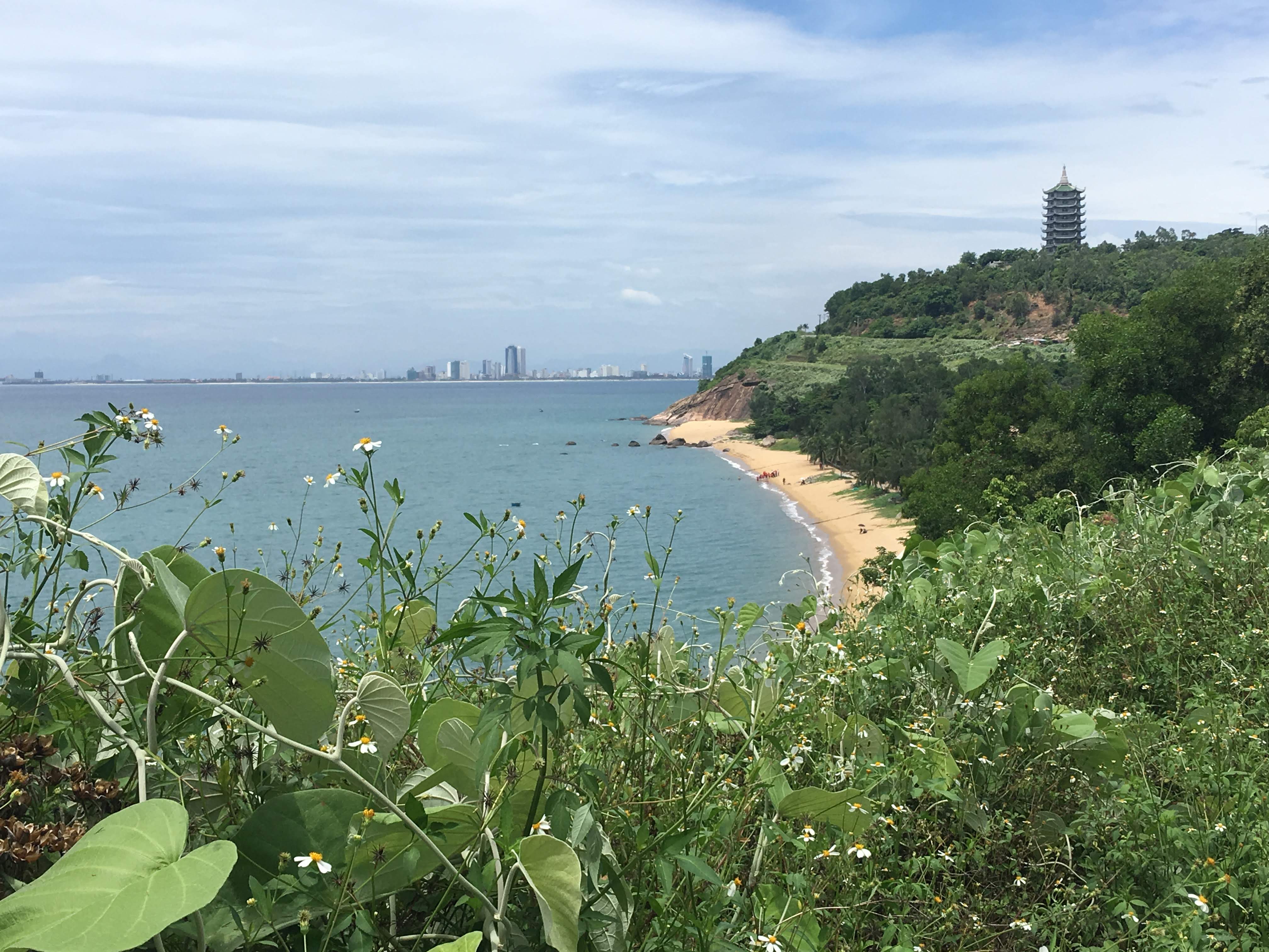
Bàn Cờ Peak at 696 metres is Son Tra's highest point and a strategically significant position throughout modern history. The name 'Bàn Cờ' (Chess Board) comes from a folk legend about a game between two immortals — their stone chessboard is said to remain on the summit. During the American war, this was the site of the STRATCOM (Strategic Communications Command) facility — a classified radar and communications system controlling military intelligence across Southeast Asia. US soldiers nicknamed the mountain 'Monkey Mountain' for the douc troops that regularly appeared around the base. Today from Bàn Cờ Peak you can see the full sweep of Da Nang Bay, Cham Island, and on clear days the faint outline of Hoi An's coastline to the south.
Son Tra faces an urgent conservation challenge: development pressure from luxury resort projects within the conservation core zone has prompted serious concern from scientists both domestically and internationally. The campaign to protect Son Tra has been championed by nonprofits, researchers, and Da Nang residents, drawing sustained national media attention over many years. The peninsula is now on the national biodiversity conservation priority list with growing zoning restrictions. Visiting Son Tra today is a privilege — but also a responsibility: every visitor who respects conservation rules casts a vote for the future of the douc langur and this singular old-growth forest.
The red-shanked douc langur is the world's most colourful primate — and Son Tra Peninsula shelters more than half of all remaining individuals.
WWF Vietnam, Red-Shanked Douc Conservation Report, 2019
Highlights not to miss.
Son Tra harbours between 50–60% of the world's remaining red-shanked douc langur (Pygathrix nemaeus) population — an Indochina-endemic primate with a five-colour coat combining red, white, black, yellow, and grey, described by scientists as 'the world's most colourful primate'. Unlike many shy monkeys, Son Tra's doucs are relatively habituated to humans and regularly appear near trails in early morning from 6–8 am to forage. Trekkers frequently encounter troops of 10–20 individuals leaping between branches directly overhead. Their current IUCN status is Endangered, making every douc encounter on Son Tra a globally rare privilege.
Bàn Cờ Peak at 696 metres is Son Tra's highest point and was once a strategically critical position during the Vietnam War: US forces stationed here the STRATCOM (Strategic Communications Command) facility — a classified radar and communications base controlling part of Southeast Asia's airspace. The name 'Monkey Mountain' was coined by American soldiers for the abundant langur population around the base. Vietnamese folklore says the name 'Bàn Cờ' (Chess Board) comes from a legendary game between two immortals on the summit — a stone chessboard marking the spot. From the peak, visitors see the full sweep of Da Nang Bay, Cham Island, and on clear days glimpse Hoi An to the south.
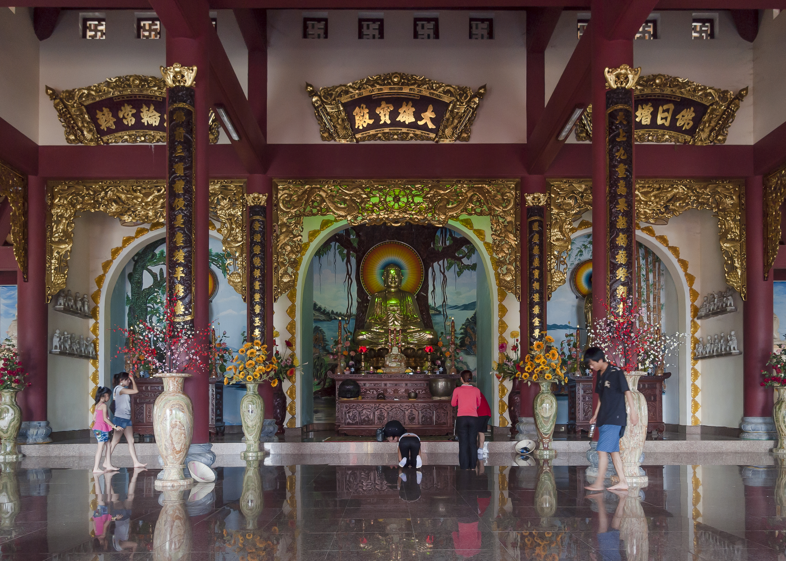
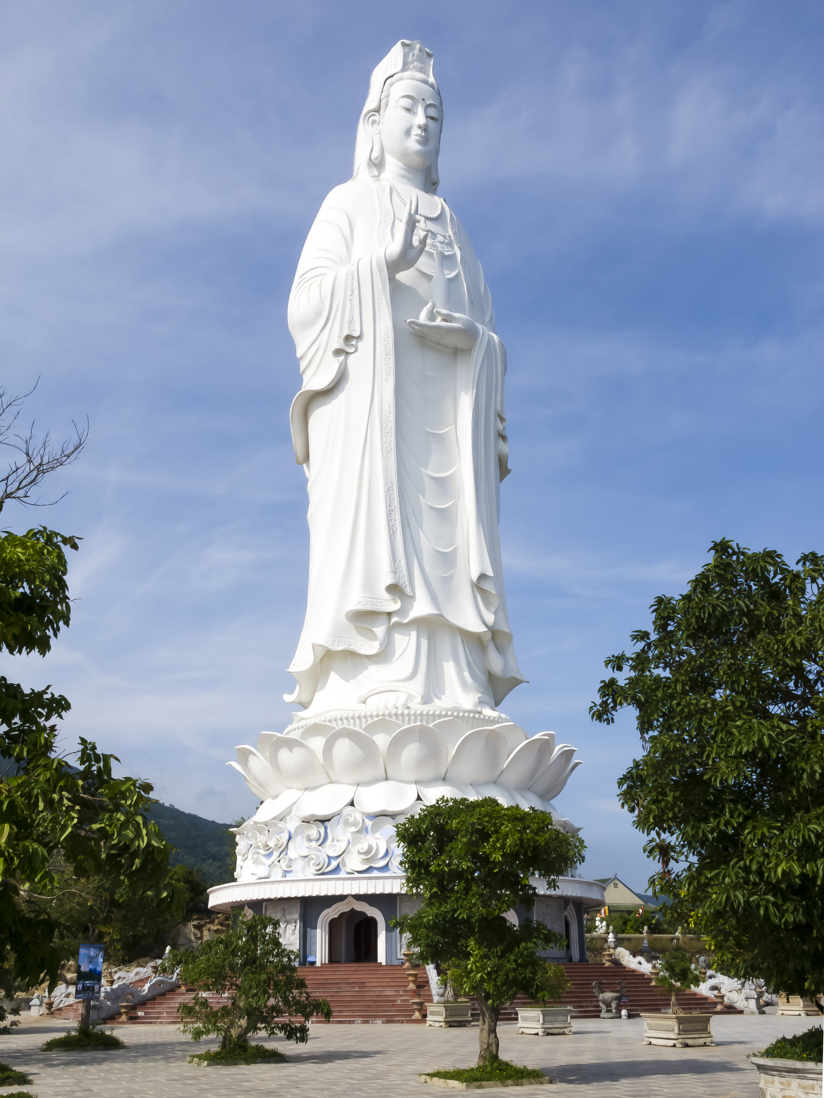
Son Tra's forest is one of the last remaining intact lowland tropical rainforests in Central Vietnam — over 4,400 hectares of continuous canopy from sea level to the 696-metre summit. This ecosystem supports 287 bird species, 106 reptile species, 32 mammal species, and thousands of plant species not yet fully catalogued. Linh Ung Pagoda at the peninsula's southwestern tip (distinct from the summit pagoda) together with its 67-metre Guanyin statue is a famous pilgrimage site gazing directly out to sea. However, the peninsula faces serious development pressure — luxury resort projects within the core zone remain a persistent concern for Vietnamese and international conservation scientists.
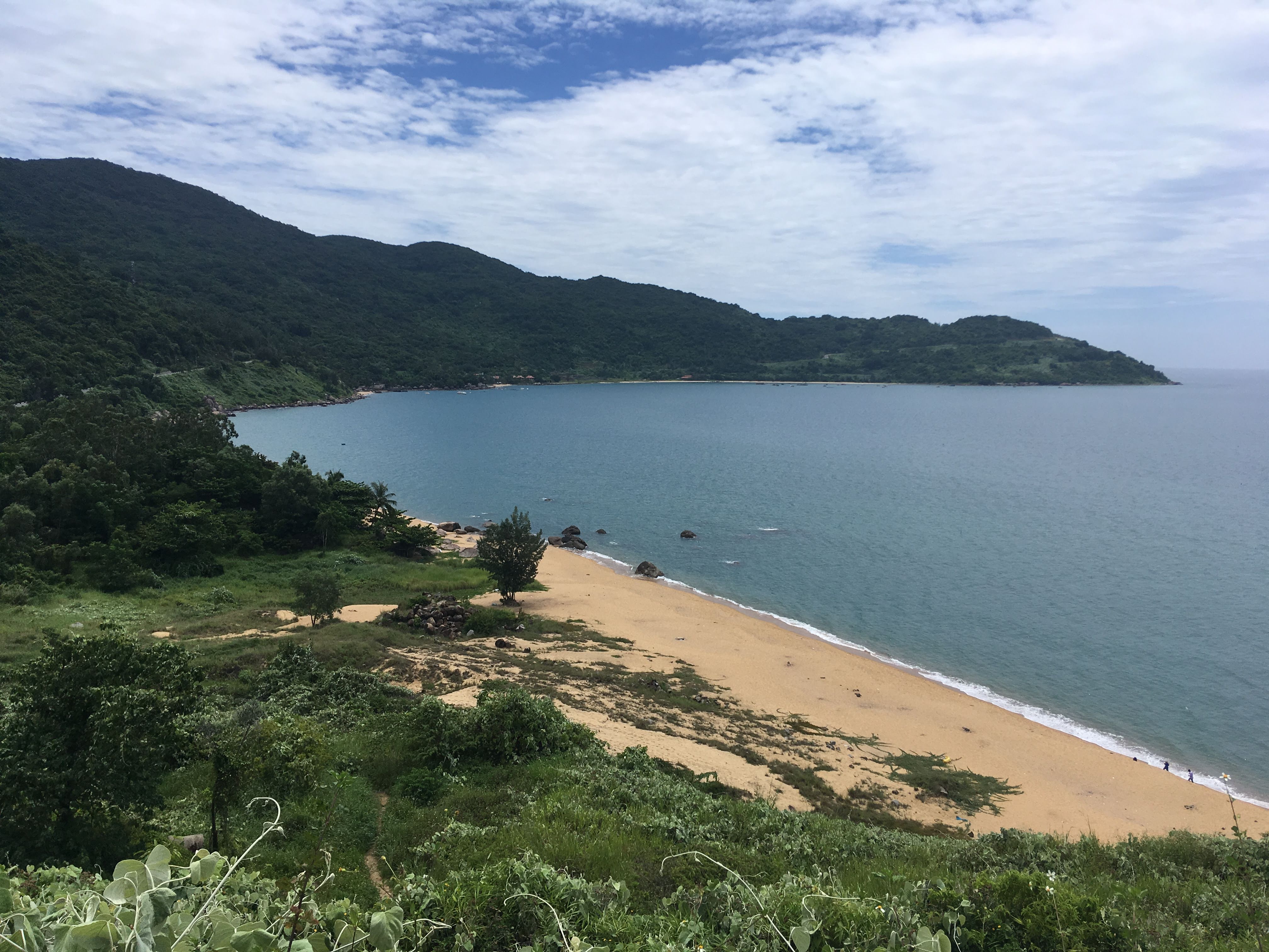
The nearly 30 km paved loop road around the peninsula is the favourite route for motorbike riders and mountain cyclists, with multiple panoramic stops overlooking Da Nang Bay and the East Sea. Bai Bac and Tien Sa beaches hide inside the sheltered bay, accessible only by boat or through-forest trekking — crystal-clear water, healthy coral reefs, and zero tourist infrastructure. The hiking trail from the southern gate to Bàn Cờ peak runs approximately 8 km, crossing small streams and dense old-growth forest sections. This represents a rare urban wilderness experience — old-growth rainforest, endangered primates, and coral reefs less than 10 minutes' ride from a city of one million.
Never feed the doucs even if they approach you — human food can harm their health and disrupt their natural behaviour. Maintain a distance of at least 5 metres and use a telephoto lens for photographs.
How to visit & get there.
Getting There and Exploring the Peninsula
Motorbike is the best option: From Da Nang city centre head northeast, cross the Han River via Son Tra or Thuan Phuoc Bridge, then follow Ngo Quyen Street up to the peninsula. The full loop around the peninsula is approximately 30 km, taking 2–3 hours with stops at scenic viewpoints. Cars are permitted but some sections near Bàn Cờ peak are narrow and steep. No public bus reaches the summit — rental motorbikes (100,000–150,000 VND/day) or taxis are the common choices. Book with local trekking companies if you want a guide knowledgeable about the forest and douc behaviour.
Douc-Watching and Forest Conservation Tips
Best time to spot doucs: Set out before 6 am — doucs are most active between 6–8 am at forest-edge zones near trails, especially from the southern gate up to km 8. Never feed the doucs — human food disrupts their digestion and alters their natural behaviour; maintain at least 5 metres distance. Bring a light jacket as Bàn Cờ peak is typically 4–6°C cooler than the city. Pack out all rubbish — the peninsula is a nature reserve; plastic bags and waste directly threaten langurs and wild birds. Best season: March–September, dry weather, long visibility, and easiest douc spotting.
Sources
- 1.Bán đảo Sơn Trà — Khu bảo tồn thiên nhiên
Cổng thông tin điện tử TP. Đà Nẵng · 2025-01-15
- 2.Son Tra Peninsula
Lonely Planet · 2025-01-15
- 3.Voọc chà vá chân nâu Sơn Trà — loài quý cần bảo vệ
VnExpress · 2025-01-15