
History & story.
Lung Cu Flag Tower stands on the summit of Dragon Mountain at 1,470 metres above sea level, marking Vietnam's northernmost geographic point. Its history stretches back to the 11th century, when General Ly Thuong Kiet first erected a sa moc timber pole here to assert territorial sovereignty. Over the centuries the flagpole was rebuilt multiple times as the nation's fortunes changed. On 18 November 2009, the Ministry of Culture designated it a National Historical and Scenic Landmark. After 196 days of construction, the current structure was inaugurated on 25 September 2010, rising to a total height of 33.15 metres.
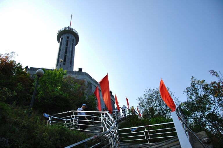
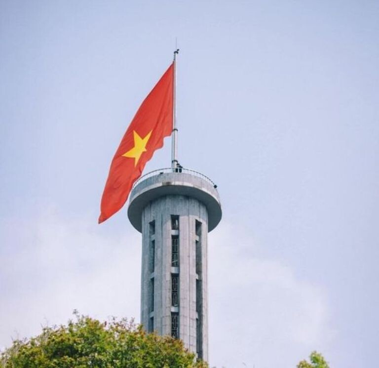
The current structure features an octagonal shaft with an outer diameter of 3.8 metres and a base column rising 20.25 metres. Eight bronze-drum faces engraved on the shaft symbolise the Dong Son civilisation — one of Southeast Asia's earliest bronze cultures. Eight blue-stone bas-relief panels encircling the column depict Vietnam's historical periods and the cultural life of Ha Giang's ethnic groups. The 54-square-metre red flag — one square metre for each of Vietnam's 54 ethnic groups — is raised on a robust pulley system and flies day and night above the windy summit. Reaching the top requires climbing 839 blue stone steps up the mountainside.
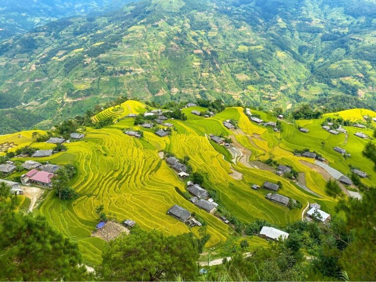
Standing at the base of the flag tower, visitors can look north into Chinese territory and survey the entire Dong Van karst plateau with its cat-ear limestone peaks floating in morning mist. Below the mountain lies Lo Lo Chai — the village of the Lo Lo people named UN Tourism's Best Tourism Village of 2025. Local H'Mong and Lo Lo residents regard the tower as a sacred object, a symbol of their villages' permanence and the nation's sovereignty. On major national holidays such as Independence Day on 2 September, thousands of residents and visitors gather here to watch the national flag fly above Vietnam's northernmost land.
Today, Lung Cu Flag Tower is an unmissable stop on the Ha Giang loop. Visitors from across Vietnam and around the world come not just for a photograph but for something more profound — the feeling of standing at the edge of the country, where territory meets sky and aspiration. At the mountain's base, a Cultural Heritage Exhibition House displays traditional clothing, tools, and artefacts from Ha Giang's ethnic minorities. From here, the road south passes through H'Mong villages, terraced rice fields, and the ancient limestone walls of the Dong Van plateau.
The 54-square-metre flag flying over Lung Cu is not merely a sovereignty marker — it is the oath of 54 ethnic peoples standing together to guard every inch of the frontier.
Báo Dân Trí, 2020
Highlights not to miss.
The ascent to the flag tower begins at the mountain's base with 839 hand-laid blue stone steps divided into three stages: the first 425 steps climb to a midway rest house, the next 279 lead to the column's base, and the final 135 spiral inside the shaft to the very top. From the summit, the entire Vietnam–China border and the Dong Van karst plateau spread out before you.
At the mountain's base, the Cultural Heritage Exhibition House preserves brocade clothing, traditional farming tools, folk instruments, and artefacts from the H'Mong, Lo Lo, Tay, and Giay communities of the karst plateau. It serves as an ideal orientation stop to absorb cultural context before making the ascent to the flag tower.
Looking down from the tower's summit, Lo Lo Chai village appears with its mossy tile roofs and rammed-earth walls more than two centuries old. This is the village of the Lo Lo people — one of Vietnam's smallest ethnic minorities — recently named the World's Best Tourism Village 2025 by UN Tourism. Pairing a visit to the village with the flag tower climb makes for a full and rewarding day at Lung Cu.
Morning light (6:30–8:00 AM) and late afternoon (4:00–6:00 PM) give the richest colours. October–November, when pink buckwheat flowers bloom around the mountain's base, is the most photogenic season of the year.
How to visit & get there.
Climbing the Tower **Wear shoes with grip** as the 839 stone steps can be slippery after rain. **Start before 8:00 AM** to avoid crowds and midday heat. Allow 45–60 minutes for the full ascent and descent depending on your pace.
Getting to Lung Cu From Dong Van town, ride a motorbike **25 km north** along a paved road winding through H'Mong villages. **Avoid riding alone after dark** — the mountain road is narrow and poorly lit. Both self-drive motorbike and xe om (motorbike taxi) options are available.
Sources
- 1.Sự đặc biệt của lá cờ trên chóp nón cao nhất mỏm cực bắc Tổ quốc
Dân Trí · 2026-06-16
- 2.Lá cờ trên cột cờ Lũng Cú diện tích bao nhiêu m2?
VnExpress · 2026-06-16