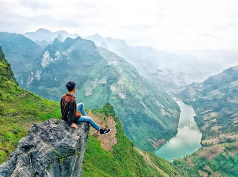
History & story.
Ma Pi Leng Pass stretches 20 kilometres along National Highway 4C, linking Dong Van and Meo Vac districts, and ranks among Vietnam's Four Great Mountain Passes alongside O Quy Ho, Khau Pha, and Pha Din. The H'Mong name means horse's nose ridge — an accurate description of the nearly vertical limestone cliff faces. At an average altitude of 1,200 metres, the pass crosses a boundary between two mountain districts with entirely different climates, ethnic communities, and landscapes. In 2009, the Ma Pi Leng area was designated a National Scenic Landmark.
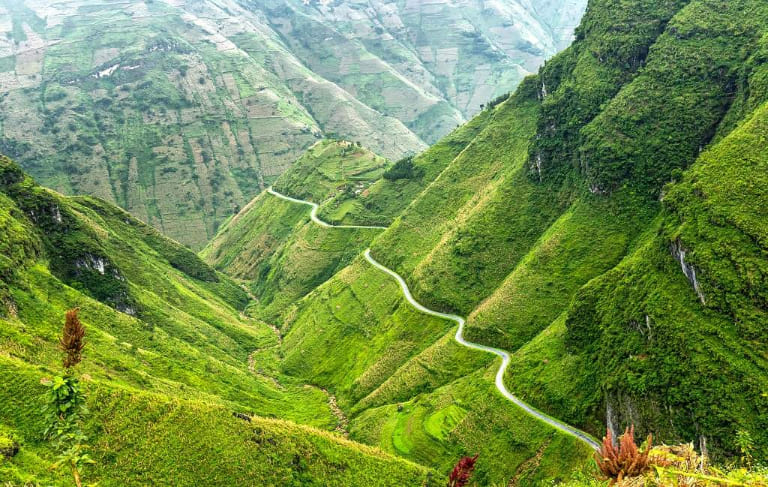
The most remarkable story tied to Ma Pi Leng is the road-opening through the pass between 1959 and 1965. On 10 September 1959, Ha Giang province began construction of the entire route from Ha Giang city to the Dong Van plateau. By 1964, when the Dong Van–Meo Vac section was underway, the 10 kilometres through Ma Pi Leng's sheer cliffs required an extraordinary solution: the Central Youth Union mobilised 300 volunteers from Nam Dinh and Hai Duong, selecting the 20 fittest and most courageous to form a suicide squad. They worked eight hours daily suspended by two tonnes of rope on cliff faces, drilling 80–100 centimetres of blast holes per person per day.
At the pass's base, the Nho Que River flows through Tu San gorge — the deepest canyon in Southeast Asia, reaching 700–900 metres at its lowest point. The river's colour changes by season: jade green in the dry season, a mysterious blue-green after rain, and muddy red-brown during floods. Visitors can hire boats at Meo Vac pier to enter Tu San gorge and view the cliffs from water level, or stand at the summit viewpoint to look down at the river as a shimmering silver thread far below.
Today, Ma Pi Leng is an indispensable stop on the Ha Giang Loop — the motorbike circuit around the karst plateau that draws hundreds of thousands of visitors every year. The Sky Walk viewpoint at the summit provides a 360-degree panorama of the Meo Vac valley and the Nho Que far below. Each season brings different beauty: spring brings red peach blossoms, summer vivid green foliage, autumn pink-white buckwheat flowers blanketing the slopes, and winter occasionally brings snow to the summit.
Every metre of road through Ma Pi Leng represents a full day's labour by one person — 2.2 million man-days for 185 kilometres of Happiness Road.
VnExpress, 2019
Highlights not to miss.
The unmissable stop at Ma Pi Leng's summit is the Sky Walk — a cantilevered glass-and-steel platform extending over the void. From here, a 360-degree view takes in the Meo Vac valley, the winding Nho Que below, and the jagged karst peaks stretching to the horizon. On early mornings when mist still fills the valley floor, the scene achieves a dreamlike quality that defies description.
From the pier at Meo Vac town, visitors can hire a motorboat (around 100,000–150,000 VND per person, 40-minute trip) to enter Tu San gorge — the deepest canyon in Southeast Asia. Aboard the boat, sheer cliff faces rise hundreds of metres on both sides while the Nho Que's jade-green water reflects the narrow strip of sky above. This is a completely different experience from viewing the gorge from the pass above.
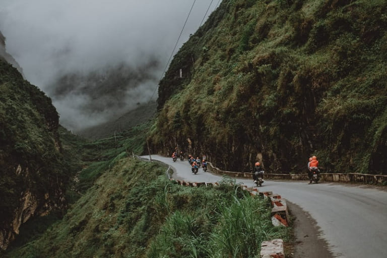
Ma Pi Leng is the most anticipated section of the Ha Giang Loop. The 20-kilometre descent from Dong Van to Meo Vac winds through hairpin turns, vertiginous drops, and constantly changing scenery — these are the most memorable kilometres on a motorbike that many visitors have ever ridden. Ride in the early morning (7:00–9:00 AM) when traffic is light and the light is clearest.
Ma Pi Leng frequently has dense fog from April to September, especially at dawn and dusk. If you encounter fog, pull over and wait — riding in thick fog on a high mountain pass is extremely dangerous. October to December offers the clearest conditions.
How to visit & get there.
Riding the Pass **Check brakes and tyres** before you start — the steep descent to Meo Vac is dangerous on poorly maintained bikes. **Do not overtake recklessly** and keep headlights on even during the day as many curves have blind corners.
Stopping Points **Stop at the Sky Walk viewpoint** (large parking area available) for photos and views of Tu San gorge. **Combine a boat trip** from Meo Vac in the afternoon after crossing the pass to experience the same landscape from two completely different angles.
Sources
- 1.Mã Pì Lèng — ý nghĩa tên gọi một trong Tứ đại đỉnh đèo của Việt Nam
Dân Trí · 2026-06-16
- 2.Những thanh niên cảm tử mở đường qua Mã Pì Lèng
VnExpress · 2026-06-16